Open Source Intelligence - Russian Military Locations
OSInt-RuMiLoc.com 
OSInt Concept Contact Air Force Air Defense Ground Force Depots POIs Oblast

RuMiLoc publishes information about Russian Military Locations such as airfields, barracks, headquarters, SAM sites, SSM sites and logistic depots extracted in general overviews and in detail in KML files

General Overview

The general overviews essentially contain interactive maps and lists with information about the geographic location of the individual locations, special military features and links to WIKIPEDIA, OpenStreetMap and Google Earth

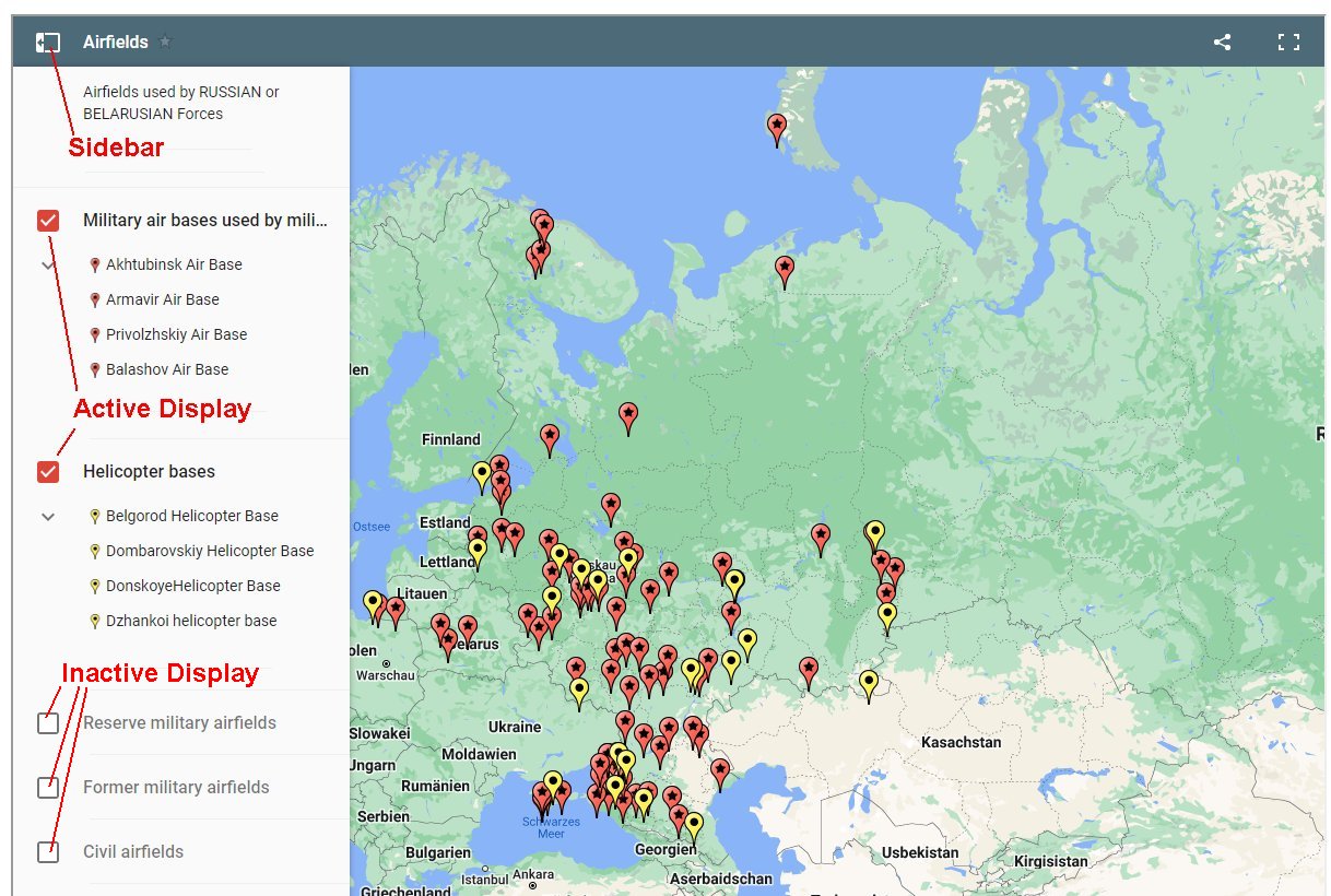
The interactive maps were set up under Google Maps. Accordingly, all functions of Google Maps can be used without restriction. A sidebar in which all locations are listed can be shown or hidden using the button at the top left. By activating / deactivating the check boxes to the left of the object categories (e.g. Helicopter bases), all locations of the category can be shown or hidden on the interactive map.

Interactive Map (OSInt-RuMiLoc)
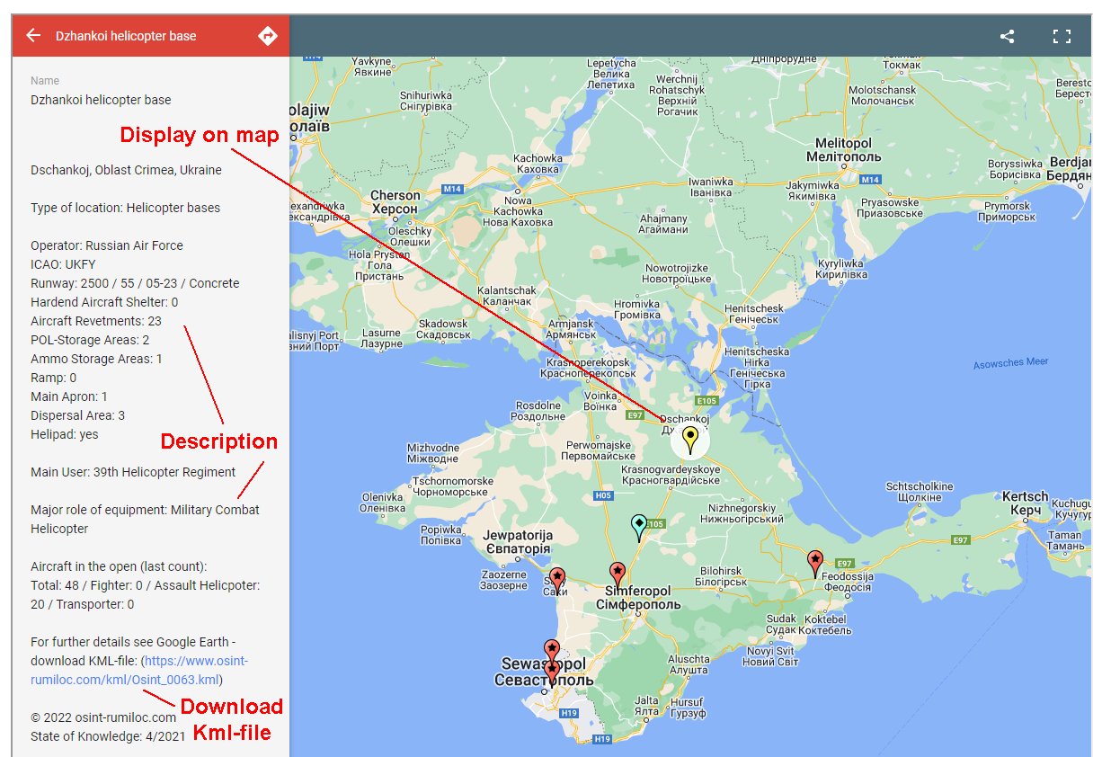
Individual locations can be called up by activating the object designation (e.g. Dzhankoi Helicopter Base). A description of the location appears in the sidebar and the interactive map is centered on the center of the location. The kml file oft he location can also be downloaded via the sidebar in order to display further details oft he location in Google Earth.
Interactive Map (OSInt-RuMiLoc)
The lists contain all locations that were previously evaluated by OSInt-RuMiLoc. The information provided differs depending on the object category (e.g. HAS - Hardend Aircraft Shelter - for airfields) and also shows the date of knowledge ("State" column). The corresponding Wikipedia page, map in OpenStreetMap and KML file (download to visualize the information on Google Earth) can be selected for each individual location via the links in the columns "Link", "Map" and "KML".
Overview


KML Files / Google Earth

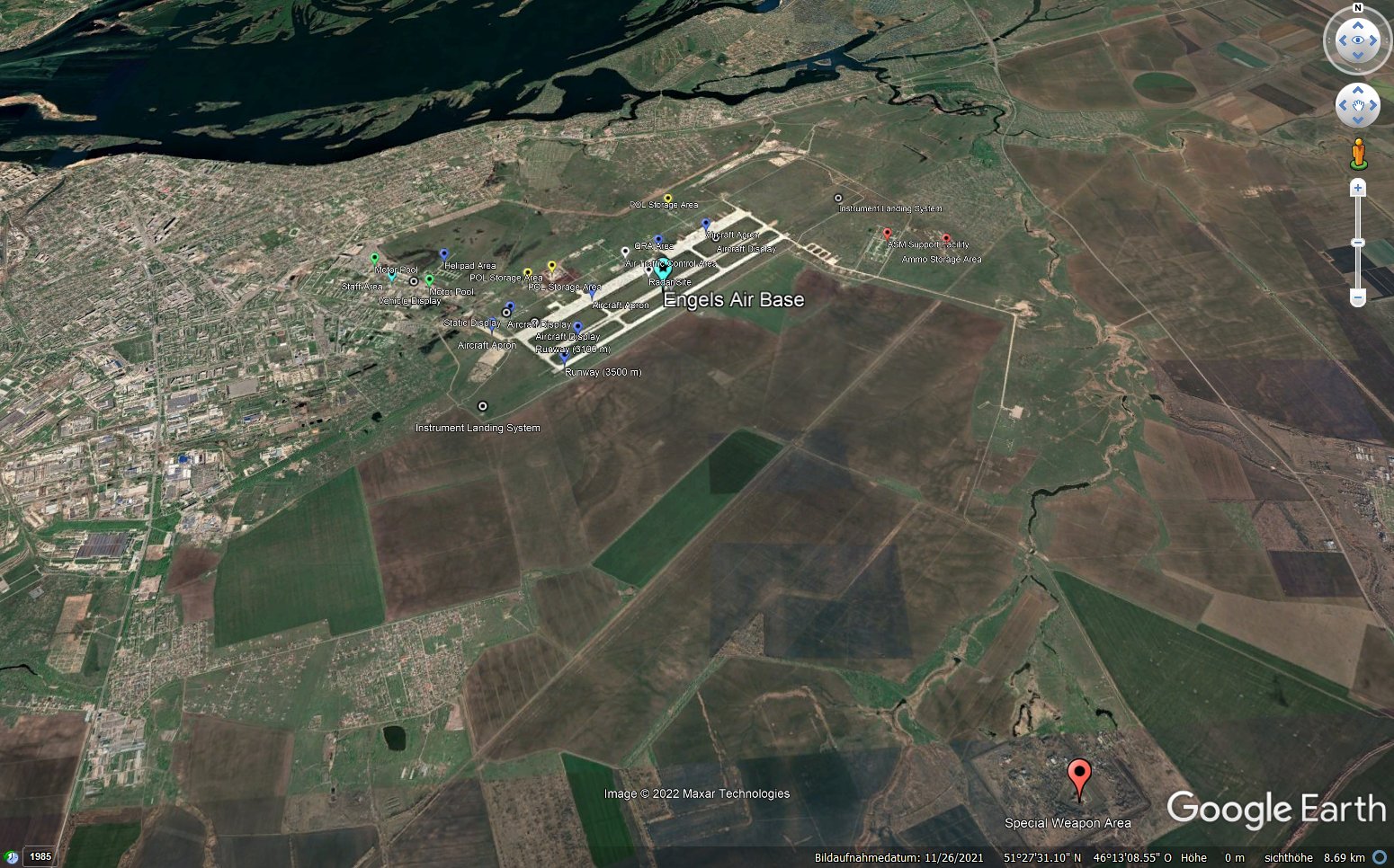
The KML files created by RuMiLoc are optimized for use with Google Earth. In order to be able to call up the KML files, it is first necessary to install Google Earth Pro. After calling a KML file from the general overview, a basic setting appears in the inclined image, in which all objects can be seen that can be assigned to the main object that has been started. For example, in the case of a military airfield, the assigned ammunition depots were often built in the wider vicinity of the airfield.


ENGELS Air Base


Source: Google Earth / Image Maxar Technologies


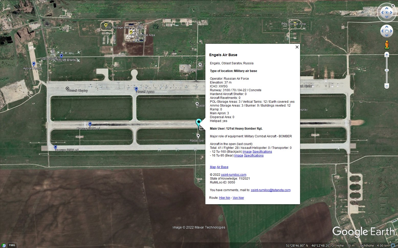
By double-clicking on the icon of the object, the display changes from inclined to vertical and the object is rotated to the longest extent (e.g. horizontal alignment of the runway of an airport). At the same time, a popup opens with a description of the object and object-related links. Comments and suggestions for additions and changes to the object can be submitted to the research-team via email  to research-team@osint-rumiloc.com.

ENGELS Air Base


Source: Google Earth / Image Maxar Technologies


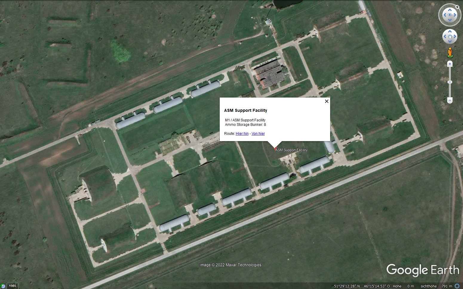
To take a closer look at a sub-area of an object, activate the icon of the required sub-area with a double click and Google Earth will zoom into the sub-area and display a popup for this sub-area.


ENGELS Air Base


Source: Google Earth / Image Maxar Technologies


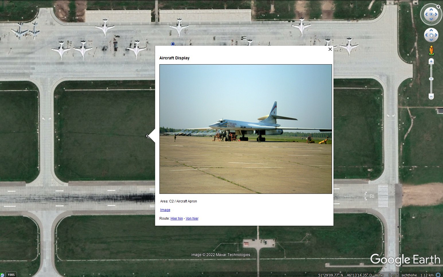
In addition, individual object points within a sub-area can also be shown separately if, for example, a ground image is available for the respective point or the points are of particular importance for other reasons (e.g. ammunition bunker). After activating an icon, Google Earth zooms in again closer to the point.


ENGELS Air Base


Source: Google Earth / Image Maxar Technologies


The satellite image displayed by default in Google Earth when called up is not always the last image currently available. As a rule, the image with the best resolution quality appears. To call up the latest available status, you must activate the timeline and call up the most recent status.
Google Earth - State og Knowlegde


OSINTREP

We regularly check all objects for changes and report on major construction work or inventory changes to weapon systems such as aircraft or tanks on our Twitter channel. 

https://twitter.com/@OSInt_RuMiLoc

Because Twitter only allows 280 characters per tweet, we report changes in objects through formatted messages. The reporting format is called "OSINTREP" and stands for Open Source INTelligence REPort. Each line begins with a record identifier (e.g. "LOC" for location), followed by the message content. The individual message contents are separated by the character "/", the end of a block is marked with "//".

This approach, using standardized abbreviations, allows as much information about an object to be included in a message as is necessary to uniquely identify a location and to describe the changes in the location. At the same time, interested parties can use this standardized reporting format to develop program routines with which the report contents can be automatically read into their own databases, archived and processed.

The permalinks of the individual messages (tweets) are entered in the balloons of the KML files for the corresponding location and can be called up in Google Earth (via Google Chrome on the right side of the Google Earth screen) in order to display the content of a message.

The following abbreviations can appear in an OSINTREP: 


Message Content * Meaning of the Abbreviations
MSGID/#OSINTREP /0001// M Message-Identification

SEC/open/#OSInt //

M Security-Level (Open Source Intelligence)

SUBJ/Unit out of Base//

M Subject of Message

LOC/Mozdok AB/#Mil //

M Location  (e.g. Mozdok Air Base) / Military Location

COORD/43.7899 N 044.5994 E//

M Coordinates - Center of a Location

UNIT/3661st Avn Base/#RUS //

M Military Unit

COUNT/EQUIP/NEW/OLD/

C Count of  Equipment (in the open)

Tu-22M/0/6/

C Table - Type of  Equipment  / New Count / Previous Count

Mi-24/4/13/

C Table - Type of  Equipment  / New Count / Previous Count

Mi-8/8/0//

C Table - Type of  Equipment  / New Count / Previous Count

REF/ osint-rumiloc.com/AB.htm#0174 //

M Reference / Record of Location in the table

IMAGE/NEW:7-2022/OLD:2-2022//

M State of Knowledge / Image

ANLYS/#RuMiLoc //

O Analyses of  Image (Google Earth)
RMRK/Destination unknown// O Remarks
* M - Mandatory, C - Conditional (depending on the subject of the message), O - Optional


Standardized Terms

When describing objects, the research team endeavors to use standardized terms for object sections and points. RuMiLoc would be happy to receive suggestions for additions and changes to the object categories airfields, barracks, headquarters, SAM sites, SSM sites and logistic depots by email to research-team@osint-rumiloc.com.


Standardized Terms
1. Sub-Areas
2. Object-Points